
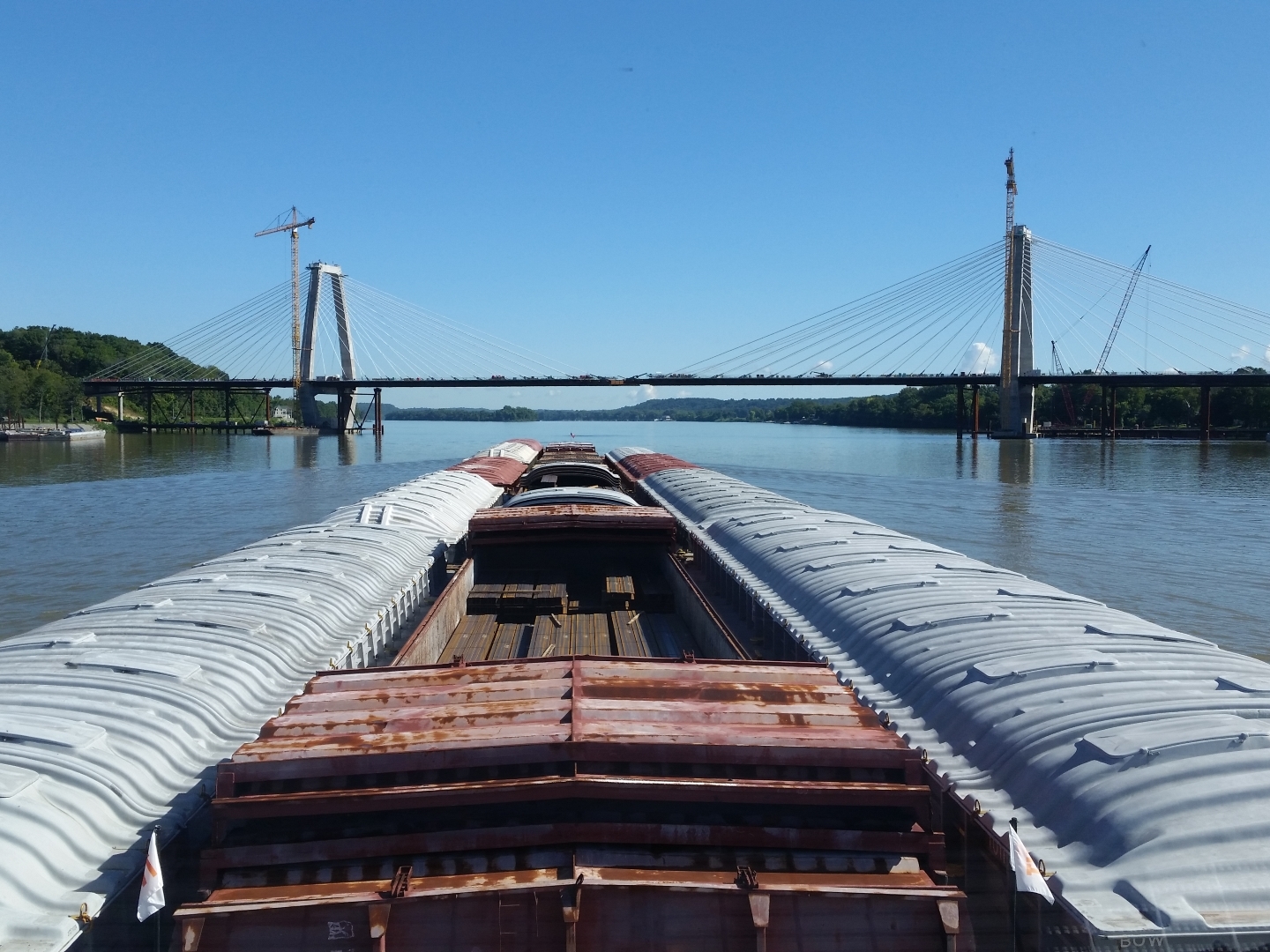
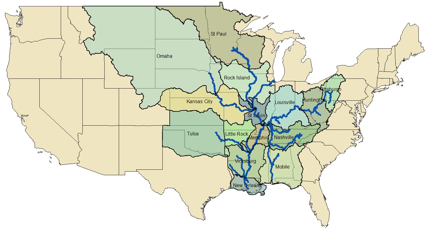
The U.S. inland navigation system consists of 8,200 miles of rivers maintained by the Corps of Engineers in 22 states, and includes 276 lock chambers with a total lift of 6,100 feet. The highly adaptable and effective system of barge navigation moves over 625 million tons of commodities annually, which includes coal, petroleum products, various other raw materials, food and farm products, chemicals, and manufactured goods (Reference Corps Navigation Data Center).
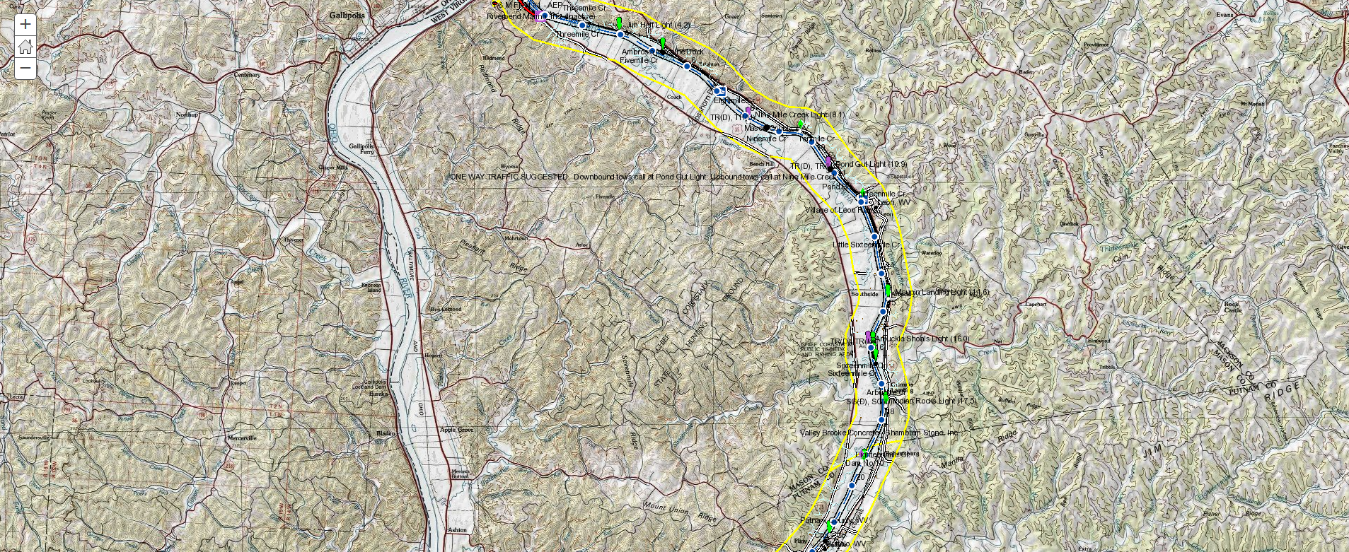
The shallow draft waterways have many unique characteristics and difficulties over coastal harbor and ocean navigation; river levels can change by over 30 feet in a seasonal cycle, the navigation channel can shift significantly within the river banks, and shifting yet ever present river currents pose constant challenges in these confined waterways. Electronic chart systems can offer significant benefits to vessels including accurate and real-time display of vessel position relative to waterway features, voyage planning and monitoring, training tools for new personnel and integrated display of river charts, radar, and Automatic Identification Systems.

This standard, which is based on the S-57 data transfer standard, allows for features which are unique to inland waterways to be accurately encoded on the electronic charts. For example, features such as Fleeting Areas, Lock Walls, and Casino Boats, etc. which are not included in the S-57 standard (designed only for maritime use), can now be accurately charted using this standard.
For chart users to report any issues that may exist with published IENCs
From their own local desktop (email, news reader, etc.) the user can pull down the data .
For software developeres and technical-savyy users to automate their data download needs.
Current USACE chart books can be purchased from the Government Publishing Office (GPO) bookstore, by accessing the USACE Navigational Chart “store”. Charts may be available at a lower cost directly from the Corps Districts, however, for consumer convenience, charts are now available for purchase through the GPO. Many hard copy chart books are available from the Corps districts. The cost, scale, features, and update cycles may be different from district to district.
Alabama River
Last published in 2016, the Alabama River Navigation Charts are available to download in pdf format (11 x 17 inches) from the Mobile District, and also available for hardcopy purchase from the GPO Bookstore.
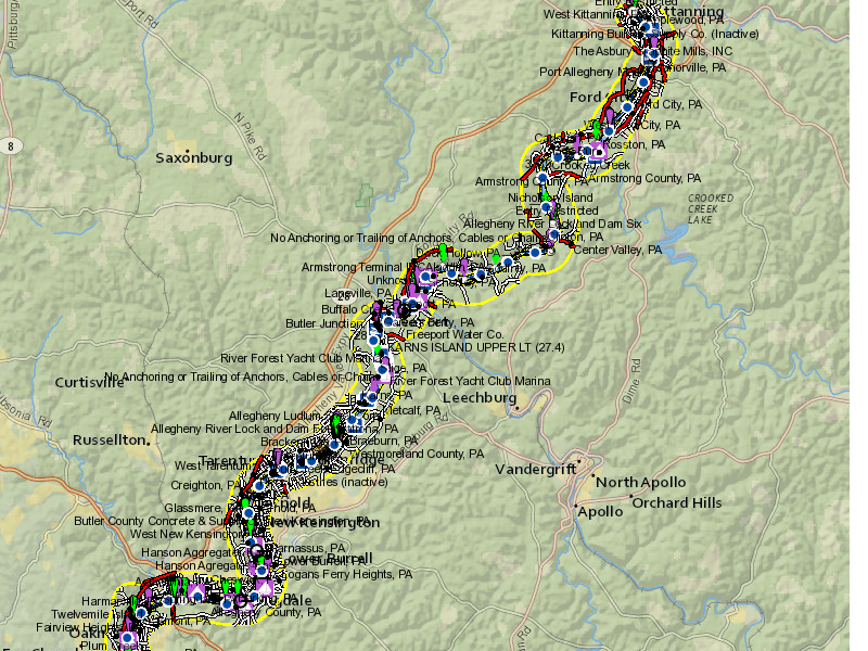
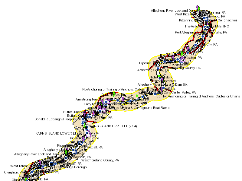
Allegheny River
Last published in 2004, the Allegheny River Navigation Charts are available for hardcopy purchase from the GPO Bookstore.
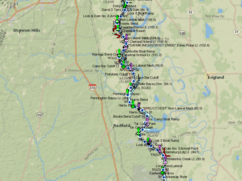
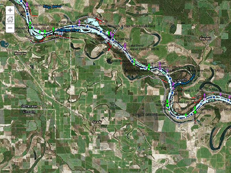
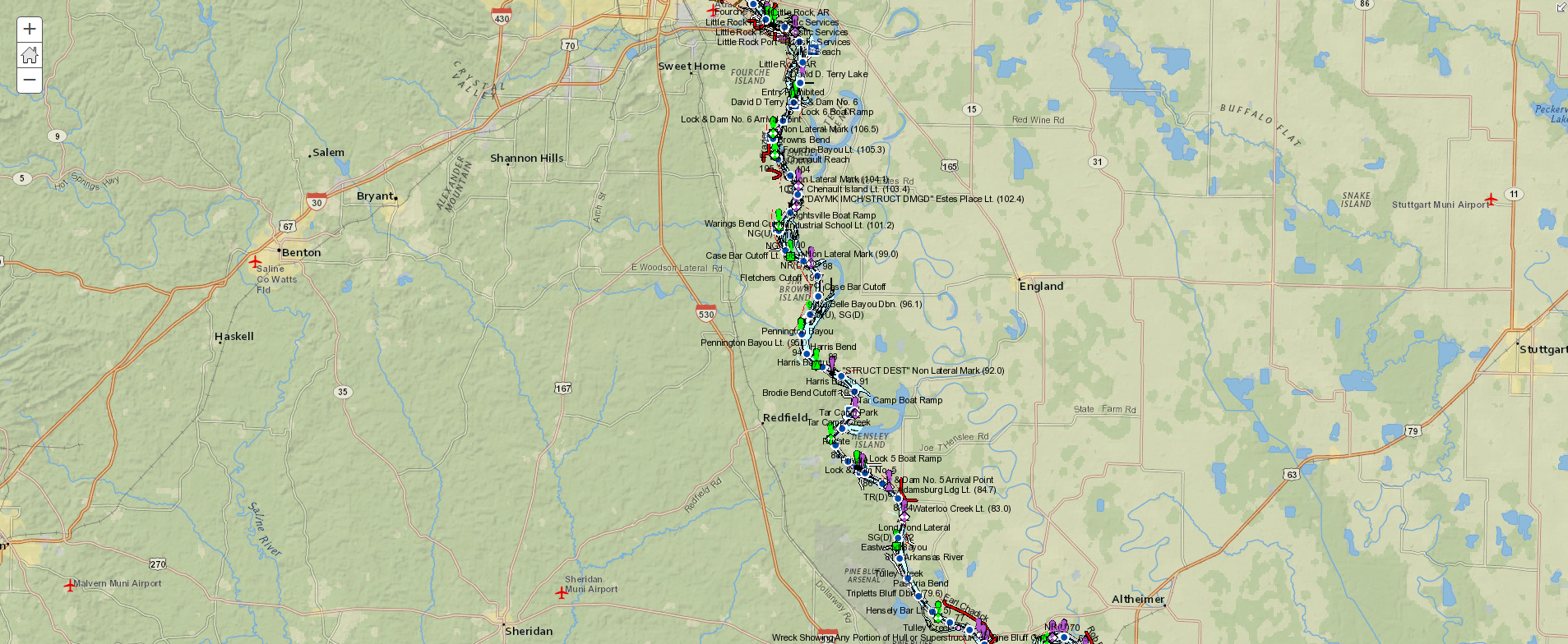
Arkansas River/MKARNS
Last published in 2016, the McClellan-Kerr Arkansas River Navigation System (MKARNS) Navigation Charts are available for download in pdf format from the Tulsa District, and also available for hardcopy purchase from the GPO Bookstore.
Atchafalaya River
Last published in 2016, the Atchafalaya River Navigation Charts are available for download in PDF format (11 x 17) from the New Orleans District or for hardcopy purchase from the GPO Bookstore.
Black Warrior, Tombigbee and Mobile Rivers
Last published in 2015, the Black Warrior/Tombigbee/Mobile
Rivers Navigation Charts are available to download in pdf format (11 x
17") from the Mobile District or for hardcopy purchase from the GPO Bookstore.
Cumberland River
Last published in 2013, the Cumberland River Navigation
Charts are available to download in pdf format from the USACE Digital Library, and also available for hard copy purchase from the GPO Bookstore.
Green River
Last published in 2018, the Green River Navigation Charts are available for download in pdf format from the USACE Digital Library, and are also available for hardcopy purchase from the GPO Bookstore.
Illinois Waterway
Last published 2013, the Illinois Waterway Navigation Charts,
including Sanitary and Ship Canal and Calumet Sag Channel, are available
for download in pdf format (11 x 17") from the Rock Island District or for hard copy purchase from
the GPO Bookstore.
Kanawha River
Last published in 2016, the Kanawha River Navigation Charts are available for download in pdf format from the USACE Digital Library,, and are also available for hardcopy purchase from the GPO Bookstore.
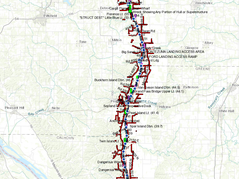
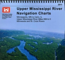
Upper Mississippi River
Last published in 2011, the Upper Mississippi River Navigation Charts are available for download in pdf format (11 x 17") from the Rock Island District or for hard copy purchase from the GPO Bookstore.
Lower Mississippi River
Last published in 2015, the Lower Mississippi River Navigation
Charts are available for download in pdf format (11 x 17") from the New Orleans District and are also available for hardcopy purchase from the GPO Bookstore.
Missouri River
The Missouri River Navigation Charts (2 chart books) are available for hardcopy purchase from the GPO Bookstore or for download in PDF format from the following websites:
Omaha District (2014) – Sioux City, IA to Rulo, NE (Miles 735-499)
Kansas City District (2014) - Rulo, NE to St. Louis, MO (Miles 499-0)
Monongahela River
Last published in 2004, the Monongahela River Navigation Charts
are available for hard copy purchase from the GPO Bookstore.
Ohio River
The Ohio River Navigation Charts (3 chart books) are available for hardcopy purchase from the GPO Bookstore, or for download in PDF format from the following websites:
Ouachita and Black Rivers
Last published in 2006, the Ouachita and Black Rivers
Navigation Charts are available for hard copy purchase from the GPO Bookstore.
Red River
Last published in 2006, the Red River / J. Bennett Johnston Waterway Navigation Charts are available for hard copy purchase from the GPO Bookstore.
Tennessee River
Last published in 2013, the Tennessee River Navigation Charts are available to download in pdf format (8.5 x 14 inches) from the USACE Digital Library, and also available for hard copy
purchase from the GPO Bookstore.
Tennessee-Tombigbee Waterway
Last published in 2013, the Tennessee-Tombigbee Waterway Navigation Charts are available in pdf format (11 x 17") from the Mobile District or for hardcopy purchase from the GPO Bookstore.
White River
Last published in 2012, the White River Navigation Charts are available for download in pdf format (17 x 11") from the Memphis District.
Mariners and other chart users are encouraged to report chart discrepancies by using the USACE IENC Chart Discrepancy Reporting Tool or the QR Code 
USACE needs help in obtaining photographs of 202 bridges on the Western Rivers.
Photo Requirements:
List of Photos needed: (Please send photos to: AGC-IENC@usace.army.mil)
For any inquiries, questions, recommendations, or to contact technical support please use the number or the email address below.