Inland Electronic Navigational Charts
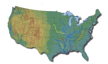
The following IENCs are currently available in Inland ENC 2.3.6 Data Standard:


- Allegheny River, Mile 0-46
- Arkansas River, Mile 0-444
- Atchafalaya River, Mile 0-118
- Black Warrior-Tombigbee Rivers, Mile 0-393
- Cumberland River, Mile 0-381
- Green River, Mile 1 -108
- Illinois River, Mile 0-322
- Kaskaskia, Mile 2 to 36
- Kanawha River, Mile 0-91
- Lower Mississippi River, Mile 236-951
- Missouri River, Mile 0-735
- Monongahela River, Mile 0-128
- Ohio River, Mile 0-981
- Ouachita River, Mile 5 to 338
- Red River, Mile 0-237
- Tennessee River, Mile 0-652 (Including Tellico, Hiwassee, Clinch and Emory Rivers)
- Tennesse-Tombigbee Waterway, Mile 218-450
- Upper Mississippi River, Mile 0-866
- White River, Mile 10-255
Inland ENC, 2.3.6 Product Specification
Newer IENCs follow the Inland ENC Product Specification, edition 2.3.
This standard, which is based on the S-57 data transfer standard, allows for features which are unique to inland waterways to be accurately encoded on the electronic charts. For example, features such as Fleeting Areas, Lock Walls, and Casino Boats, etc. which are not included in the S-57 standard (designed only for maritime use), can now be accurately charted using this standard.
For details on how real-world features are charted in these IENCs, please refer to the Inland ENC Encoding Guide, Edition 2.3.6.
The Encoding Guide provides a framework for IENC specifications by:
1. Using existing IHO S-57 Edition 3.1 standard. Specifically, the:
 [Maritime] ENC Product Specification (Appendix B1)
IHO Object Catalogue (Appendix A)
Object Catalogue (Appendix B.1, Annex A)
2. Defining the mandatory requirements for safety-of-navigation on inland waterways.
3. Recommending object classes, attributes, and attribute values for encoding IENC data.
For all object classes, attributes, and attribute values that are used in conjunction with an IENC, the Encoding Guide:
2. Describes its relationship to the real-world entity
3. Provides criteria for its proper use
4. Gives specific encoding examples